100 plus temperatures and smoke billowing through the Leavenworth valley = time for a road trip! So we packed up for a bike tour of the western US to escape the fires. The goal: ride the west from Washington to Arizona, and back again, while exploring and discovering whatever might present itself along the way. The riders: 4 loco Peshastin Flakes. The wagon: 1 Dodge Ram Diesel w/ vintage 4-Wheel poptop camper and Thule bike rack. The ponies: 2 Intense Slopestyles, 1 Intense Uzzi and 1 Intense Tracer.
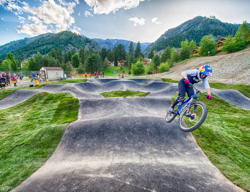
First stop: Post Canyon out of Hood River, OR. The Hood River Area Trail Stewards have been working on this trail system for years and recently they’ve installed toilets and other amenities at the bike staging areas. One of these, The Family Man, is a great camp spot with a pump track, several balance features and a jump line.
For our first ride of the trip we shuttled the full Super-D. There are many trail crossings and it can be confusing as we quickly learned when we got lost and ended up on the Spaghetti Factory Trail which led back to Family Man before dropping into the 7-Streams (effectively doubling our intended ride). We soon discovered Bad Motor Scooter to GP, a bermed out smooth trail, could be lapped quickly so we hit it like 4 times. A smallish jump line above this called Extended Play caused the first casualty of the trip where I overshot the first jump in a series of gaps and planted my front wheel into the face of the second. The sidewall on my brand-new UST Continentals stretched on impact completely destroying the tire. Then the very next morning, the jump line on Family Man claimed a derailleur. Not gonna make it far at this rate… We were saved by Kurt at Discover Bicycles. After telling Kurt our story he promptly put all his scheduled work aside to get us back on track. Great guy!
- Quick Tip: When visiting this area definitely stop by the The Hood River Waterfront Park. This community park allows easy access to cool off in the Columbia River as well as a small dock with taco stand and other eatables.
Refreshed from the river and with bikes back in operating order, we turned south.
On to Oakridge, OR. Here we were greeted by the Sram Team van, then the Santa Cruz van, Diamondback, and on and on… Apparently, unbeknownst to us, Mountain Bike Oregon was later this week. We had landed here just in the nick-of-time to ride and get out before the trails were overtaken by the masses. Riding three days around Oakridge we hit Larison Rock, Flat Creek (3 times), Hardesty, Goodman Creek, and Lawler trails. All distinct in some way; but all super fast, fun, and flowy. And all in super old growth timber with loamy soft soil. A++
- Quick Tip: The Alpine Trail is all the rage in Oakridge but there are so many other trails that are logistically easier to ride/shuttle not to mention less crowded. The Flat Creek Trail might be the raddest quintessential Pacific NW trail ever! A must ride. Also, just a few miles up from the lower Flat Creek TH is Salmon Falls Campground –a great site with clear waterfalls.
We skipped town just as the crowd was building for the weekend event (we did crash the party before leaving tho -ha! take that Santa Cruz).
Now on to the famed Downieville, CA. We found a great campsite at the top of Mills Peak with surrounding views in stereo. The Mills Peak Trail is a fast rocky undulating 2,500 foot descent of pure goodness and can be accessed from the town of Graeagle, CA. It’s a nice ride to open the morning and ends directly on the access road to Packer Saddle, which is the drop-in for the popular Downieville Classic DH.
We left or trusty covered wagon at the top with the idea to grab a shuttle service from Downieville Outfitters to retrieve the truck later. Ooops… Although this trail is admittedly awesome, it also has A LOT of sharp rocks. Three flat tires later and there was just a sliver of chance to catch the last shuttle service. But that just wasn’t what was in store for us. After exclaiming that there will be absolutely “NO MORE FLATS!” I ripped an apple slice sized gash into my remaining (also brand new) tire. Add to that yet another pinch flat and all hope of making the shuttle was flushed. With dried up patch glue and all spare tubes gone, we lucked out big-big by finding a fresh tube just hanging on a trail sign. Thank-you someone!
Haggard and tired we coasted into town too late for a return ride. What to do? What else? Put the seat up, pound some water and turn some cranks back to the peak. 18 miles and over 5,000 feet of climbing later, I got to the truck just at dusk. Whew!
- Quick Tip: Camping at the top of Mills Peak was all time. And in hindsight, I’d suggest completely skipping the DH Classic in favor of multiple shuttle laps on the Mills Peak Trail.
Next stop: Lake Tahoe. We ate a quick lunch looking out over the lake and then dropped in on the renowned Rim Trail.
Probably some of the smoothest single track of the trip so far. Hardly any switchbacks too, just good open, cupped turns. We then drove into town to look for replacements spokes, patches, tubes, etc. to recover from the great Downieville debacle.
In Incline Village we found The Village Ski Loft to have knowledgeable bike mechanics and a huge stock of parts –they even had my specific Deemax spokes. Here we did some much-needed laundry while fixing the bikes. Next stop: central Nevada.
Austin, NV to be precise. Apparently in the early 2000’s some local guy attempted to transform this old Pony Express town into a mountain bike mecca. Or at least pretended to as we soon found out. Mary, the proprietor of the local saloon tells me that he “was run out of town”. Fitting for an old 1860’s western town I guess. Disappointing though to find the trails in disrepair and TH totally abandoned. It’s one thing to find old towns in ruins but to also have the trails that way was quite a bummer. No matter. The double track roads and cow paths down mountains over 11,000 feet high were ample relief. Then stumbling on to an old silver mineshaft made it all worth the effort.
- Quick Tip: If ever driving through Nevada, definitely check out the Toiyabe National Forest. Huge mountains with roads and tracks everywhere. Also just past the town of Kingston is where we found the mineshaft that came complete with a scary swooping bat.
Delving further south into the heart of the desert it was 120 degrees as we cruised our carriage down The Las Vegas Strip.
The entire trip so far had lakes, rivers, and streams to cool off in, but the only water in this neck of the woods is “Lake” Mead. Not really a lake. More like a lukewarm bath in murky infested slime mud of a cesspool reservoir; not much for relief from the heat. We promptly left for the vastly superior river site, Willow Beach.
- Quick Tip: Hit up the Colorado River access at Willow Beach just to the south of Hoover Dam. Super cold, clear water with few people around. “Almost” made it feel like it was only a mere 100 degrees!
The temperature quickly abated as we headed up the Colorado Plateau towards Flagstaff, AZ. Just north of Flag is Mt Elden where there’s an entire network of trails to shuttle or pedal. We headed up to the Oldham Trail and had just finished the first lap when the thunderstorm hit. All our gear was soaked in a matter of seconds. Turning tail, we rushed outta there and headed for a small Arizona town to rest, visit family, old friends and sleep in a real bed –a nice break to reset for the return leg.
Moab, UT! The well-known Porcupine Rim Trail is only the lower part of something much bigger coming out of the La Sal Mountains. Starting at Warner Lake, Hazard County to Kokopelli to UPS to LPS to Porcupine Rim is an all out 20+ mile 6,000 foot descent across cactus riddled redrock. A definite recommended ride.
Purple thunderheads built overhead as we dropped in and several minutes into the ride the lightening started to crackle. The storm chased us down the entire trail. At the last section lightening was crashing all around us where one even visibly hit the surface with orange flame. We reached the bottom seconds after the rain cloaked the valley. We so lucked out on that one…

Quick Factoid: That grayish peak in the middle of Castle Valley below is a salt diaper that rose up through the broad sandstone anticline that makes the rim.
- Quick Tip: You can miss most the storms with an early start (obviously not what we did). The combined ride from the La Sals down to the Colorado River is called the Whole Enchilada. We skipped the Burro Pass section since access at Warner Lake is so easy. A great option would be to take shuttle turns on just the upper section, Hazard County. This section of the trail has micro-berms through aspen groves and subalpine meadows and the paved La Sal Loop Rd intersects it at the lower end. Hands down the best portion of this epic trail.
From Moab it was mainly a B-line outta the lovely state of Utah as the thunderstorm continued to chase us across the entire Wasatch Front. We hit the rain shadow a few hundred yards into Idaho where we found a place to camp in the Sawtooth NF with some nice cowpaddy double track.
The following day we worked our way up the Payette River to Cascade, ID. Here we stumbled on to yet another great single-track ride, The Eagle Nest Trail. This winding trail had broad, soft-turns in pure granite sand and offered stellar views of the valley and Payette Lake below.
Around half way down we came across some barefoot “humanoid” tracks interspersed within some previous bike tread. Hem? Could that of been that weird smell I noticed a while back? The breaking branches we heard the night before? Or just maybe all this riding had started going to my head.
We turned back for Leavenworth with 10 mountain ranges across 7 states on 18 new trails under our belt. Crossing into Washington we were greeted with 110-degree weather with a huge wildfire plume looming from the direction of Mt Adams. I guess we came full circle; right back to where we started in the heat and smoke of summer. Not much of a fire escape I guess. I suppose a road trip only provides temporary reprieve from these things. But damn it’s good to be home; even if we just got put on Level 2 evacuation notice. Doh! Didn’t see that one coming…

Good ‘ol paper maps will never be replaced by the internet. These maps were key in finding all the great trails we rode, and dirt roads we drove throughout the trip.

A: Hood River B: Oakridge C: Graeagle D: Downieville E: Lake Tahoe F: Austin G: Flagstaff H: Moab I: Sawtooth NF J: Cascade, ID K: Peshastin, WA


