Boulder-covered peak of Tumwater Mountain
On Monday, May 14th, some friends and I hiked up Tumwater Mountain that creates natural Northwestern boundary of Leavenworth, WA. The trailhead starts at the end of Ranger Rd, off of Skill Hill Dr. In years past, the metal access gate would be opened allowing vehicles with decent ground-clearance and tires to drive the majority of the way to the summit. As of Monday, the gate was still closed making the summit a 2+ hour brisk-hike away.
I suspect the road will remain closed for some time due to a section of the trail about ½ way up that looks like it could easily slide if the weight of a vehicle got to close to the edge. There are also a few small areas with snowpack still on the trail, though easily traversable in shoes. There’s a good parking area that holds a few cars just below the gate at the end of Ranger Rd. On your hike up, turn left at both splits on the trail to reach the summit.

Dustin Basalla on the summit of Tumwater Mountain (Icicle Ridge left)
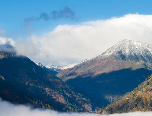
The top of the mountain is sprinkled with large boulders providing those with the ability to do some light climbing and scrambling with unmatched views and the feeling of being suspended in the sky. From the summit, look Southeast out over Leavenworth and see the Wenatchee River carving its way through the valley. To the west, Icicle Ridge with its snow-covered peaks looms across Tumwater Canyon, with visible rapids of the Wenatchee River raging thousands of feet below. Total roundtrip time from the gate to the summit and back was about 3 hours including a 10 minute stop at the summit. Bring plenty of water and maybe a light snack to recharge your body for the hike down.

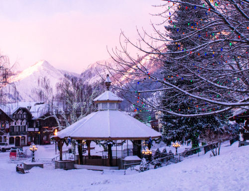
View of Leavenworth from Tumwater Mountain. Photos by Andy Jaynes.